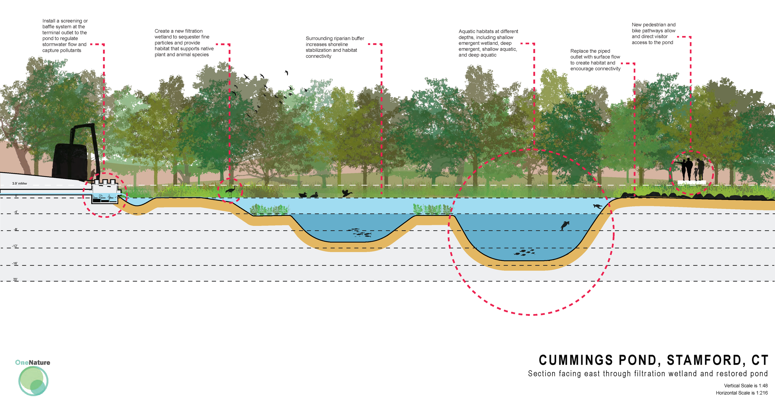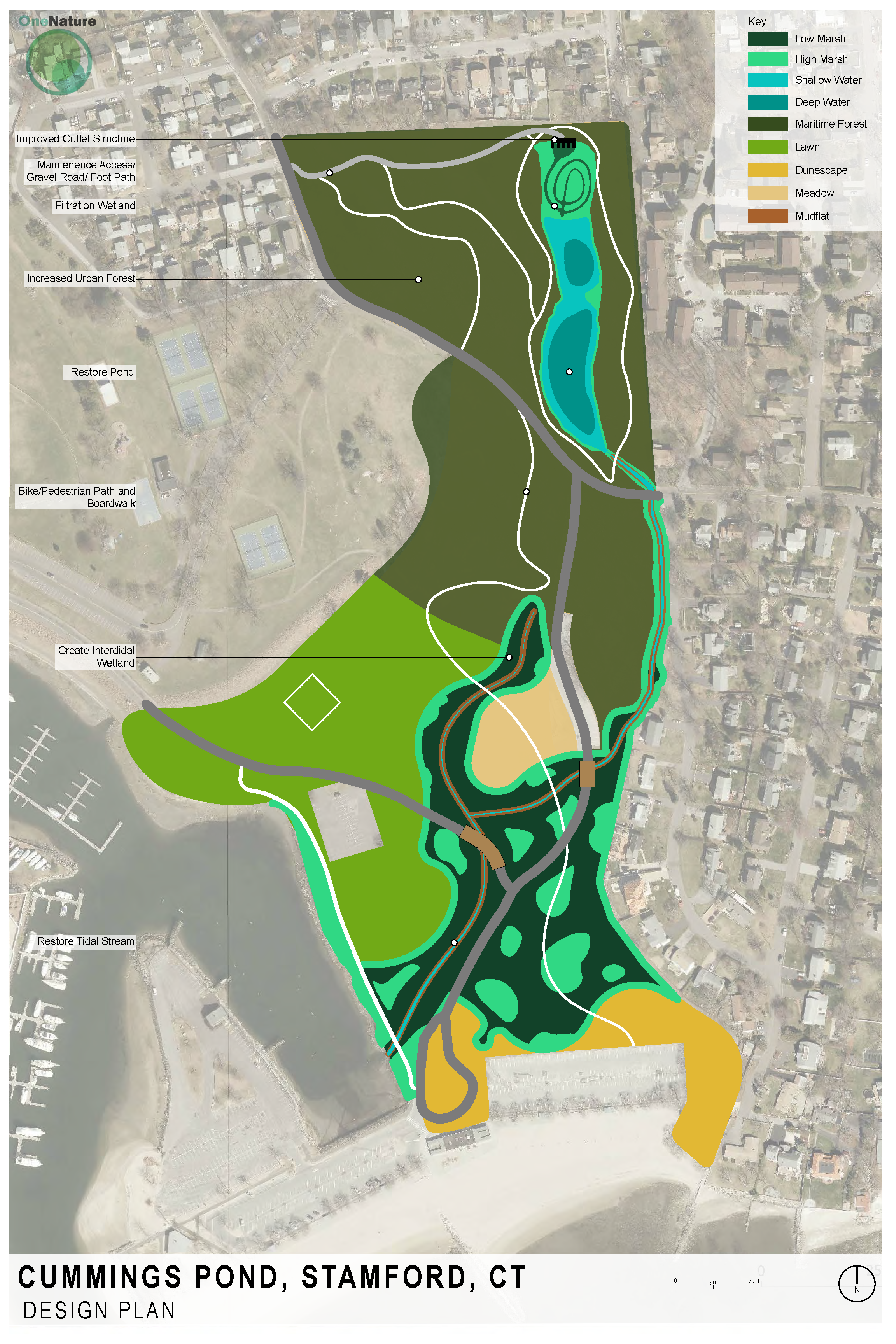
In Stamford, Connecticut, community members and local environmental stakeholders expressed concerns over the degradation and pollution of Cummings Pond, which has been altered over recent decades by urban development and sediment deposition. In response, our team has provided research-driven consultation and ecologically-principled recommendations that take into account the larger context of the pond. To do this we reviewed existing documentation and historical aerial photographs, then identified the major causes of alterations to the pond. We also conducted a vegetation survey around the pond perimeter, and along the riparian corridor leading downstream to the sound. In our analysis of the system’s hydrology, we used GIS to delineate the sewershed surrounding the pond, created an elevational cross section of the site relative to tide levels, conducted volumetric flow calculations based on precipitation and storm data, and analyzed sea level rise projections for the area.
Based on our research, field studies, and calculations, we developed an illustrative vision that would: 1) Modify the upper drainage basin to improve downstream water quality, 2) Restore the riparian buffer around Cummings Pond and create varying elevation wetland habitats across the site, and 3) Daylight the buried tidal stream and create additional intertidal marsh habitat. We’ve included marsh creation as a response to our analyses of sea level rise and the problem of marsh migration. Rising sea levels will inundate lower lying areas to the point that marshes will be unable to thrive, and human infrastructure in upland areas will prohibit marsh migration to higher elevations.
The infrastructural and ecological changes proposed will restore vital ecological functions, reduce water pollution, mitigate future climate and sea level rise impacts, and provide lasting scenic value for community members.