Habitat Assessment and Monitoring
Our team provides detailed habitat assessments that combine natural resource inventories with spatial analyses and literature reviews. We have extensive experience in a variety of upland and wetland habitats, including forests, floodplains, riparian corridors, intertidal zones, lakes, meadows, and more. Vegetation surveys are provided by trained botanists, who take a detailed account of both native and nonnative species in the tree, shrub, herbaceous, and vine layers. We also use GIS mapping software to provide spatial details that help our team and clients alike understand the habitats in question. Spatial analysis includes elevation, topography, historic land use, flood data, watershed delineation, and more. The data provided by our assessments are analyzed and presented in a way that allows for a shared and collaborative understanding of the habitat’s current condition, as well as its future potential. Our habitat assessments also inform a number of broader projects that range from private landscapes to natural resource impact assessments to large-scale ecological masterplans.
Initial habitat assessments are often just the first step in a long-term process of seeking to understand a place. At the timescale of ecosystems, meaningful data typically only emerges over time, not just in a moment. Ongoing monitoring is a crucial component of understanding and managing habitats. We are committed to creating detailed monitoring plans and implementing them so that data can be collected in an organized and practical manner over time. Some of our key monitoring projects include:
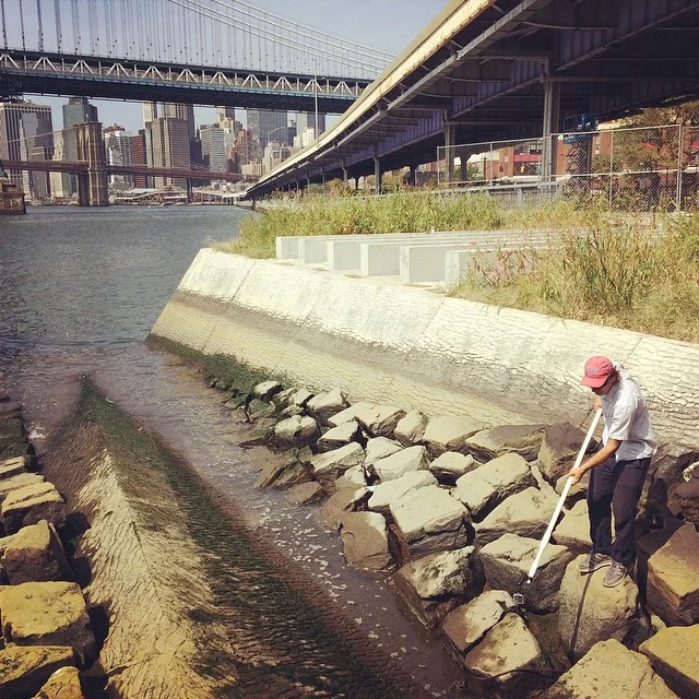
Analyzing site conditions and collecting water quality data at an intertidal waterfront habitat in Lower Manhattan. Data on aquatic invertebrate and algae populations were collected and biotic recruitment patterns were analyzed for report to the NY Department of State.
Hydrological evaluation of a brook with emphasis on threats to native fish populations. Hydrologic data collected included water volume, velocity, depth, and temperature over a six-month period. Analysis of data revealed insights into stream flow dynamics and their relation to brook trout populations. Our interpretation of the data resulted in recommendations for steps to restore healthy, year-round flows to the degraded portions of the waterway.
Monitoring the health of novel plant assemblages across four different forest communities. Vegetation surveys were conducted at the different forest plots, and individual trees observed for growth and health.